Sorry, no content matched your criteria.
The techniques utilized by nautical archaeologists to explore the ocean depths can be widely employed in other oceanographic disciplines, including but not limited to: marine geology, ecology, biology, chemistry, physics, and engineering. RPM Nautical Foundation has participated in various projects over the past decade that exemplify the applications of such advanced technology to marine science applications. Click on a topic below to learn more.
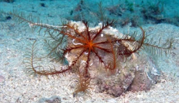
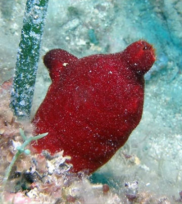
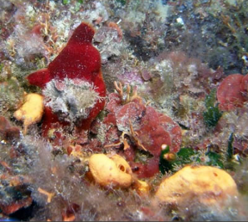
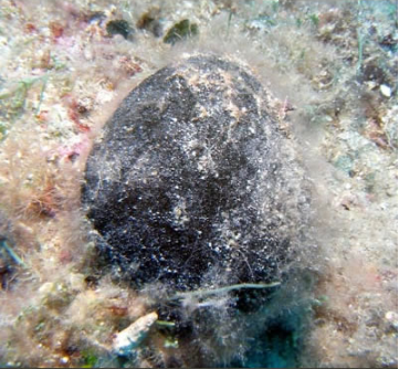
Biology of Archaeology
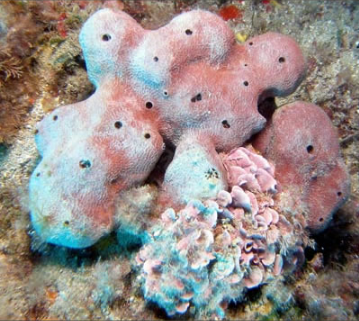
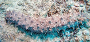
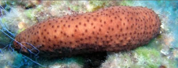
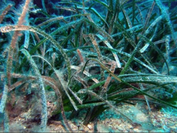
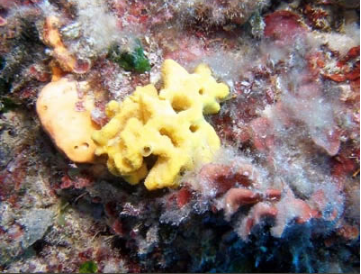
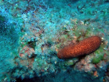
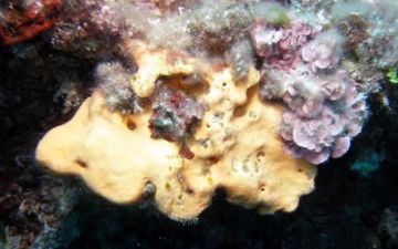
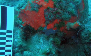
Read More There is little doubt we as a society have an innate desire to explore the farthest reaches of the ocean. Even the most remote archipelago in the world has more than one million people currently living in its islands. Despite our long tradition of establishing cultural connections, expanding trade and commerce, and overcoming tremendous odds in adverse conditions, not all human interactions with the sea have been a success. The material record of past civilizations and our continued ocean exploration along every coastline help unravel the intricate tale of our rich maritime heritage. While traditional archaeological surveys and documentation provide an ever-growing historical record and database of activities, little is known about the ecological communities specifically associated with submerged cultural resource sites being discovered and studied. These often unintentional disturbances present a unique opportunity to study anthropogenic impacts on biological communities in every type of habitat. Archaeological and ecological science can benefit from collaborative studies of the material remains from such disturbances and the effects of introduced foreign materials on the biological community structure. Our knowledge of the dynamic ocean landscape has increased greatly in recent years as a result of a multidisciplinary approach to studying the environment. It is fast becoming essential to integrate submerged cultural resources and the study of their associated environment in ecosystem-based management initiatives as well as to inform preservation and conservation decisions on their behalf. Submerged cultural resource sites discovered off the coasts of southern Albania and the Egadi Islands near Sicily are being investigated to determine if the affected areas support different levels of biodiversity compared to their surrounding habitats. Increased spatial heterogeneity (i.e. the benthic landscape), initial and continued environmental disturbance, altered micro-scale oceanographic variables (e.g. currents and shading), and the addition of foreign materials into the ecosystem are some of the possible explanations for observed differences in the flora and fauna in these areas. Contributed by: Derek Smith, University of Washington > Read Less
Ecological Communities & Submerged Cultural Sites
A multi-method approach for benthic habitat mapping of shallow coastal areas with high-resolution multibeam data
Read More The coastal waters of the Maltese Islands, central Mediterranean Sea, sustain a diversity of marine habitats and support a wide range of human activities. The islands’ shallow waters are characterised by a paucity of hydrographic and marine geo-environmental data, which is problematic in view of the requirements of the Maltese Islands to assess the state of their coastal waters by 2012 as part of the EU Marine Strategy Directive. Multibeam echosounder (MBES) systems are today recognised as one of the most effective tools to map the seafloor, although the quantitative characterisation of MBES data for seafloor and habitat mapping is still an underdeveloped field. The purpose of this study is to outline a semi-automated, Geographic Information System-based methodology to map the distribution of habitats in shallow coastal waters using high-resolution MBES data. What distinguishes our methodology from those proposed in previous studies is the combination of a suite of geomorphometric and textural analytical techniques to map specific types of seafloor morphologies and compositions; the selection of the techniques is based on identifying which geophysical parameter would be influenced by the seabed type under consideration.We tested our approach in a 28 km2 area of Maltese coastal waters. We tested our approach in a 28 km2 area of Maltese coastal waters. Three data sets were collected from this study area: (i) MBES bathymetry and backscatter data; (ii) Remotely Operated Vehicle imagery and (iii) photographs and sediment samples from dive surveys. The seabed was classified into five elementary morphological zones and features – flat and sloping zones, crests, depressions and breaks of slope – using morphometric derivatives, the Bathymetric Position Index and geomorphometric mapping. Segmentation of the study area into seagrass-covered and unvegetated seafloor was based on roughness estimation. Further subdivision of these classes into the four predominant types of composition – medium sand, maerl associated with sand and gravel, seagrass settled on sand and gravel, and seagrass settled on bedrock – was carried out through supervised classifications of morphometric derivatives of the bathymetry and textural indices of backscatter, based on information from training stations. The resulting morphologic and seabed composition maps were combined to plot the distribution of the predominant habitats in the coastal waters offshore NE Malta, some of which are of high conservation value. Ground-truthing of the habitat map using ROV imagery and dive observations confirms that our approach produces a simplified and accurate representation of seafloor habitats while using all the information available within the MBES data sets. Shallow coastal zones represent some of the most productive environments of the ocean and are characterised by complex mosaics of benthic habitats (Eyre and Maher, 2011; Gray, 1997). Knowledge of the spatial distribution, quality and quantity of these habitats is fundamental to our understanding of marine ecosystems and our ability to protect them from anthropogenic impacts (Jackson et al., 2001). Habitat maps have thus become a major tool in the assessment and monitoring of coastal marine systems, as well as in marine spatial planning, resource assessment and offshore engineering. Historically, seafloor classification has largely been based on the collection of physical samples and divers’ observations. In the last two decades, multibeam echosounder systems (MBES) have gained broad acceptance as a means to map large areas of the seafloor and delineate them into geological and geomorphological regions (Kostylev et al., 2001; Todd et al., 1999), to map the distribution of biological systems (Kostylev et al., 2003; McGonigle et al., 2009) and to identify archaeological components (Singh et al., 2000). The reasons for the increased popularity of MBES are numerous. First, MBES provide continuous acoustic coverage of large swathes of the seafloor; in comparison, sampling and diving cover significantly smaller areas and are therefore less cost effective (Kenny et al., 2003). Second, recent developments in marine acoustic technology have allowed MBES to match or supersede other types of conventional acoustic survey systems (e.g., single beam echosounder, side scan sonar) as a mapping tool (Brown and Blondel, 2009). This is particularly the case for multibeam backscatter data, which today give as much, or more, detail than is available with side scan sonar systems alone (Le Bas and Huvenne, 2009). The possibility of collecting high-resolution bathymetric and backscatter data simultaneously has thus led to a preference of MBES over side scan sonar as a marine mapping tool (Brown et al., 2011). Seabed geology, in particular topography and composition, is known to influence benthic community structure and ecological processes at many spatial scales (Bourget et al., 1994; Cusson and Bourget, 1997; Guichard and Bourget, 1998; Kostylev et al., 2001; Snelgrove and Butman, 1994) and is becoming an important component of seabed and habitat mapping programs (e.g., Cochrane and Lafferty, 2002). Conventionally, segmentation of MBES data sets into seabed geological features has been carried out manually (e.g., Todd et al., 1999). Manual segmentation is inherently subjective, slow and potentially inaccurate (Cutter Jr et al., 2003), which is problematic in view of the subtle variations that may be present in acoustic responses, the large volumes of data being collected during modern surveys, and the increase in seabed mapping programmes worldwide (Blondel and Go´mez Sichi, 2009). There is thus a need to develop quantitative, computational techniques that are robust, accurate and unbiased (Cutter Jr et al., 2003). These techniques should rapidly transform large areas of spatially-complex bathymetric and backscatter data into simple, easily-visualised maps that supplement the interpreter with as much information as possible. Mitchell and Clarke (1994) were among the first to quantitatively characterise seabed geology using both bathymetric and backscatter data. The quantitative classification of MBES data is an advancing field, and several different approaches are currently under development and reported in the literature (e.g., Erdey-Heydorn, 2008; Lamarche et al., 2011; Marsh and Brown, 2009; Wright and Heyman, 2008). The coastal waters of the Maltese Islands, Mediterranean Sea, are characterised by a paucity of detailed hydrographic and marine geo-environmental data. This is problematic in view of the requirement of the Maltese Islands to implement the regulations associated with the European Union Marine Strategy Framework Directive by July 2012. The Marine Strategy Framework Directive requires member states to carry out an initial assessment of the environmental status of their marine waters. Among the characteristics required to fulfil this initial assessment are: (i) topography and bathymetry of the seabed, (ii) predominant seabed and water column habitat type(s) with a description of the characteristic physical and chemical features, such as depth, structure and substrata composition of the seabed. Considering that Maltese coastal waters are also prone to various types of anthropogenic impacts, there is an urgent need to develop tools for the rapid and accurate mapping of the Maltese seabed and to produce good quality maps of its shallow seabed habitats. The objectives of our study are therefore to: (i) outline a quantitative, semi-automated method to map the distribution of seafloor composition and morphology; and (ii) to test the applicability of this method in shallow coastal waters. We carry this out using high-resolution multibeam bathymetry and backscatter data, together with precisely-geolocated Remotely Operated Vehicle (ROV) imagery, dive observations and seabed samples, acquired offshore the Maltese Islands. Download the Article to Read More
Abstract
Introduction
> Read Less
Multibeam Sonar Technology and Geology to Interpret Ancient Harbor Subsidence off Crotone Peninsula, Italy
Read More During the past half century, there has been an increased number of projects conducted in offshore coastal and shelf settings in different world regions and this has fostered closer research collaboration between marine geologists and archaeologists. The hammer, camera, compass and tape measure commonly used by diving geologist are often supplemented by equipment to recover subsurface sediment, including drills and vibracores. In addition to these are high-resolution subbottom seismic and side-scan systems, ROVs and submersibles that are also included in the earth scientist’s tool kit, especially when working in deeper settings. To the above, one should add multibeam sonar, a widely available technology that details the seafloor surface, a zone usually poorly defined by subbottom geophysical profiles due to the indistinct seismic signal usually obtained at and just beneath the water-bottom interface. To date, this technology remains underutilized by marine scientists attempting to resolve seafloor surface and geoarchaeological problems in marine environments. The present study provides an example of the use of the MBS system applied specifically to a problem of archaeological site identification in what can be defined as a zone of extensive subsidence off Calabria’s Crotone peninsula, southern Italy (fig. 1). MBS technology was developed after World War II as an acoustical observational method for naval research projects that required considerably more precise and realistic images of the ocean floor than had previously been available by single beam systems. Rendering of three-dimensional visualization of bottom surface features obtained rapidly over broad areas is a particularly attractive aspect of the technology, and for this reason it is now widely used for systematic seafloor mapping and varied offshore hydrographic purposes (HugHes Clarke et al., 1996; lurton, 2002). This acoustic system, one that records a broad swath of seafloor data, has been commonly employed since the 1970s by the offshore oil and gas industry. It is also increasingly applied to harbor management studies, marine civil engineering projects, fishery surveys and other purposes where it is essential to depict seafloor features in detail and accurately record their position and depth. Examples of the now diverse and practical applications of MBS are provided on search engines. MBS, sometimes in conjunction with side-scan sonar, has been increasingly used during the past 3 decades for offshore archaeological exploration on shallow continental shelves, in deeper marine environments, and also in estuaries, lagoons and lakes. These swath acoustic systems have been particularly valuable for examination of recent shipwrecks and other anthropogenic debris such as airplanes, military armament and construction materials (Mayer et al., 2007; Dean et al., 2007), as well as ancient shipwrecks now resting or partially buried on the seafloor (Foley et al., 2009). Most recently, MBS has proven helpful in the investigation of once subaerially-emerged coastlines and discovery of associated archaeological sites and materials that are now submerged, sometimes to considerable depths, in aqueous environments (royal, 2008; niCkerson et al., 2010). A case study is presented here in which MBS is applied to a geoarchaeological problem on the Ionian continental shelf off the coast of Calabria, southern Italy. Attention is paid primarily to a sector positioned seaward of Capo Colonna and Punta Scifo (fig. 1), where features of questioned origin lie in a geologically complex and recently modified tectonic sector off the Crotone peninsula (fig. 2). Databases used are those collected in 2005 by RPM Nautical Foundation (royal, 2008). The investigated seafloor relief features, including anthropogenic targets of interest, were originally discovered by means of MBS analysis in an area southwest of the Capo Colonna headland and about 250 m south of Punta Scifo (royal, 2008, his seafloor target coded AE/AF in his figs. 2 and 9). This AE/AF site on the inner continental margin (site 14 in fig. 2) was also visually examined in 2005 by divers and interpreted by Royal as part of a now submerged harbor facility of probable Greek Archaic age. This was based on construction style and comparisons with associated features and settings as illustrated and discussed at length later in this article. It comprises target AE, a long narrow structure attributed by him to be a breakwater. Northeast of the breakwater structure, there are also two large square and flat-surfaced blocks (target AF) interpreted by Royal as piers. These AE/AF structures now rest on the seafloor at a depth of about 12.5 to 13 m below present mean sea level (m.s.l.). Royal proposed that AE and AF were once part of a harbor facility that functioned from ca. 700 to 300 B.C., and then were submerged, perhaps during, or following, late Greek to Roman time. It is of note that these same features were subsequently reinterpreted by another archaeologist, D. Bartoli (2010), not as anthropogenic in origin but as naturally deposited rock strata, with royal’s (2008) proposed breakwater attributed to a possible beachrock origin. Bartoli based his conclusions in part on the long narrow shape of the rock structure and absence of ceramic sherds and other human artifacts associated with it; he also calls attention to the considerable seafloor depth on which the associated AE/AF features occur. One of his main arguments is that it would have been unlikely that the AE/AF targets identified by royal (2008), and attributed to quarried stone, could have been submerged to a much greater depth than that of the quarry which supposedly supplied the calcarenite blocks used to build it. Bartoli contends that if the blocks had indeed been obtained from such a quarry, it would have been necessary to transport them from a source locality well to the north of where the AE/ AF structures now lie, i.e. one likely positioned much closer to the present shoreline. By this reasoning, he proposes that the source quarry, which he locates in the now-submerged Bay of Punta Scifo (Bartoli, 2010, his p. 405 and fig. 6), was of roughly equivalent age (Archaic to Hellenistic Greek). However, this proposed quarry at ~6 m below m.s.l. is at a much shallower depth than the AE/AF structures. Bartoli (2010, his p. 406) thus remains “skeptical that an Archaic breakwater could be located 13 m deep.” Several pertinent questions as to the origin of the AE/ AF targets thus need to be addressed. Were these structures positioned south of Punta Scifo actually of human construction, i.e. once part of a harbor installation built along a former coastline during the Greek Archaic period, perhaps as early as 2800-2700 years ago? Were they still above sea level as recently as the 4th century BC as suggested on the basis of what is known of ancient Greek Kroton and its associated sanctuary of Hera (Juno) Lakinia, of which vestiges remain on the Capo Colonna headland (CerCHiai et al., 2004)? Or, are the structures, especially the AE target, formed of beachrock and therefore of natural origin? In either case, beachrock or breakwater, it becomes necessary herein to explain how such features normally associated with coastal to shallow marine settings could have been lowered to their present considerable seafloor depth (13-12.5 m) in a time-span as brief as ~2300 years. Our investigation pursues these matters of origin and submergence using a multi-pronged geoarchaeological approach. It takes into consideration (1) direct observational records on the seafloor obtained by divers, including photographs and direct measurements of the AE/AF structures of interest in the study area. This is needed primarily to address the question of whether the AE/AF targets are of human construction or natural origin. If this question can be resolved, then (2) the direct diver records of the ocean floor are to be integrated with images derived from the 2005 MBS datasets that have been reprocessed specifically for this present study by applying up-dated stateof-the-art electronic software systems. It would also be useful (3), to identify and interpret the numerous small (few cm) to large (more than 100 m long) physical (sedimentary, tectonic), non-archaeological features on the seafloor of the study area; these had not received attention during the first analysis of MBS records by royal (2008), or in the subsequent studies by Bartoli (2008, 2010). For this exercise, (4) an attempt is made to compare some of the physical features recorded by MBS on the submerged shelf margin with physical features identified on land in the proximal Crotone peninsula. This approach may perhaps provide some new insight on seafloor subsidence, or absence of such movement, in this area. Our investigation pursues these matters of origin and submergence using a multi-pronged geoarchaeological approach. It takes into consideration (1) direct observational records on the seafloor obtained by divers, including photographs and direct measurements of the AE/AF structures of interest in the study area. This is needed primarily to address the question of whether the AE/AF targets are of human construction or natural origin. If this question can be resolved, then (2) the direct diver records of the ocean floor are to be integrated with images derived from the 2005 MBS datasets that have been reprocessed specifically for this present study by applying updated state-of-the-art electronic software systems. It would also be useful (3), to identify and interpret the numerous small (few cm) to large (more than 100 m long) physical (sedimentary, tectonic), non-archaeological features on the seafloor of the study area; these had not received attention during the first analysis of MBS records by royal (2008), or in the subsequent studies by Bartoli (2008, 2010). For this exercise, (4) an attempt is made to compare some of the physical features recorded by MBS on the submerged shelf margin with physical features identified on land in the proximal Crotone peninsula. This approach may perhaps provide some new insight on seafloor subsidence, or absence of such movement, in this area. Download Article to Read MoreMultibeam sonar (MBS) technology was developed to examine in great detail large stretches of the seafloor surface, providing accurately positioned and excellent 2-D and 3-D images of features as small as a few centimeters or covering areas as large as hundreds of square meters. In the present study, such high quality images obtained in plan and oblique views are used primarily for archaeological purposes as related to geological (sedimentological and tectonic) parameters. Presented here as example is an area on Calabria’s Ionian coastal margin, the Capo Colonna-Punta Scifo shelf platform located off the Crotone peninsula. We show how multibeam sonar can help solve geoarchaeological problems with respect to identification, origin, and subsidence of seafloor structures that were once positioned near a former coastline but now rest at a considerable depth of 12.5-13 m below sea level. MBS images, coupled with diver observations, indicate the structures are of human construction, not of natural origin, and were once part of a now-submerged Greek harbor facility. These structures are positioned on a seafloor that subsided by ~10 m since late or post-Greek time; submergence occurred not by mass gravity flow processes, but by a number of tectonic pulses over time that most probably involved lowering by extensional faulting and possible strike-slip events. Linear structural features observed on the seafloor show axial trends similar to those mapped on land, indicating that both subaerial and submerged areas of this Calabrian Arc sector were modified tectonically to the present time. Multibeam data show that this Crotone shelf platform has been subject to considerable structural offset and subsidence on Calabria’s Ionian margin since ancient Greek time.
I – Purpose of Study
> Read Less